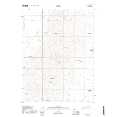
2018 Map of Fagin Mountain
USGS Topo · Published 2018About this map
The Simpson Park Mountains dominate this high-desert landscape along the boundary of Lander and Eureka counties. The terrain is defined by a dense network of drainages and springs essential for survival in this arid environment, including Pine Mountain Spring, Petunia Spring, and Fagin Spring. High elevations are marked by Buck Mtn and Fagin Mtn, while narrow passages like Deer Pass provide natural routes through the steep ridges. The western edge opens into Grass Valley, where Grass Valley Rd provides the primary corridor for movement. This area is heavily dissected by numerous canyons, such as Moonshine Canyon, Hiller Canyon, and Sheep Corral Canyon, which channel seasonal water from the peaks toward the valley floor through intermittent streams like Underwood Cr and Horse Cr.
Find a feature on this map
40 named features on this map. Tap any name to fly to it.
Don’t see what you’re looking for? This feature index may not catch every label — zoom into the map to look around manually.
Map Details
Editions of this 2018 Fagin Mountain Map
This is the sole edition of this map. No revisions or reprints were ever made.
Other maps of this area

1926 · Roberts Mountains
USGS Topo · 1:250,000

1929 · Roberts Mountains
USGS Topo · 1:250,000

1949 · Roberts Creek Mtn
USGS Topo · 1:62,500

1951 · Roberts Creek Mtn
USGS Topo · 1:62,500

1955 · Millett
USGS Topo · 1:250,000

1956 · Bartine Ranch
USGS Topo · 1:62,500

1956 · Walti Hot Springs
USGS Topo · 1:62,500

1956 · Ackerman Canyon
USGS Topo · 1:62,500

1959 · Millett
USGS Topo · 1:250,000

1979 · Simpson Park Mtns
USGS Topo · 1:100,000