
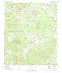
1972 Map of Fair Oak Springs
USGS Topo · Published 1974About this map
Heucks Retreat and the surrounding timberlands of Lincoln County appear here in the early 1970s, defined by a network of rural churches and persistent watercourses. The landscape is carved by the Fair River and Little Fair River, with numerous family-named landmarks such as Maxwells Branch and Walkers Creek feeding the drainage system. Transportation relies on the Illinois Central Gulf railroad and an old RR grade that snakes through the northern hills near the Heucks Lookout Tower. Rural life centers on congregational hubs like Hopewell Ch, Big Springs Ch, and Macedonia Ch. The map also documents the industrial presence of multiple Gravel Pits, some of which have matured into landmarks like Gravel Pit Lake. This record is particularly valuable for genealogists, as it preserves the locations of the Smith Cem and Kees Cem amidst the shifting agricultural boundaries of the era.
Find a feature on this map
33 named features on this map. Tap any name to fly to it.
Don’t see what you’re looking for? This feature index may not catch every label — zoom into the map to look around manually.
Map Details
Editions of this 1972 Fair Oak Springs Map
This is the sole edition of this map. No revisions or reprints were ever made.
Other maps of this area

1953 · Natchez
USGS Topo · 1:250,000

1956 · Natchez
USGS Topo · 1:250,000

1959 · Natchez
USGS Topo · 1:250,000

1970 · Topeka
USGS Topo · 1:24,000

1970 · Nola
USGS Topo · 1:24,000

1971 · Oma
USGS Topo · 1:24,000

1972 · Ruth
USGS Topo · 1:24,000

1972 · Bogue Chitto
USGS Topo · 1:24,000
1972 · Stronghope
USGS Topo · 1:24,000

1972 · Brookhaven
USGS Topo · 1:24,000