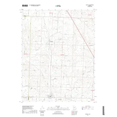
2017 Map of Fair Play
USGS Topo · Published 2017About this map
Fair Play serves as the primary hub in this southwest Missouri landscape, where the town’s grid meets a network of country roads near the southern edge of the survey. The terrain is defined by a dense system of waterways, including Bear Creek and Jump Off Cr, which drain the undulating fields of Polk and Cedar counties. Northward, the village of Dunnegan sits at the intersection of local routes near Dunnegan Spring. This 2017 study illustrates a rural environment deeply rooted in its local history, evidenced by several small cemeteries such as Bushy Creek Cem and Pickel Cem. The map reveals the persistence of family-named landmarks and natural springs, like Cave Spring, which have long anchored the community. It provides a contemporary view of the region's agricultural layout, where secondary roads like S 40th Rd and E 380th Rd carve through the drainage basins of Campbell Br and Barren Cr.
Find a feature on this map
76 named features on this map. Tap any name to fly to it.
Don’t see what you’re looking for? This feature index may not catch every label — zoom into the map to look around manually.
Map Details
Editions of this 2017 Fair Play Map
This is the sole edition of this map. No revisions or reprints were ever made.
Other maps of this area

1884 · Bolivar
USGS Topo · 1:125,000

1886 · Stockton
USGS Topo · 1:125,000

1892 · Bolivar
USGS Topo · 1:125,000

1939 · Arnica
USGS Topo · 1:24,000

1941 · Arnica
USGS Topo · 1:24,000

1942 · Elkton
USGS Topo · 1:24,000

1944 · Humansville
USGS Topo · 1:24,000

1949 · Elkton
USGS Topo · 1:24,000

1950 · Elkton
USGS Topo · 1:24,000

1950 · Cliquot
USGS Topo · 1:24,000