2021 Map of Fair Play
USGS Topo · Published 2021About this map
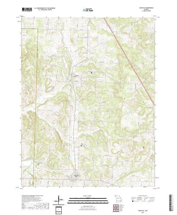
Fair Play and Dunnegan anchor this part of the Missouri landscape where the border of Cedar Co and Polk Co meets a dense network of creek drainages. The area is defined by the winding paths of Jump Off Cr and Spring Cr, which carved the terrain long before the grid of country roads like E 380th Rd and S 33rd Rd was established. Notable for genealogists, several family and community burial sites are preserved here, including Dunnegan Cem and the Bushy Creek Cem. The hydrology of the region is further highlighted by named points like Dunnegan Spring and Cave Spring, which likely served as early local landmarks for the agrarian communities that settled these hills. The map illustrates a contemporary view of these established rural townships as they appeared in the early 2020s.
Find a feature on this map
70 named features on this map. Tap any name to fly to it.
Don’t see what you’re looking for? This feature index may not catch every label — zoom into the map to look around manually.
Map Details
Editions of this 2021 Fair Play Map
This is the sole edition of this map. No revisions or reprints were ever made.