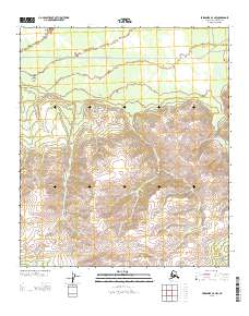
2013 Map of Fairbanks A-4 NW
USGS Topo · Published 2013About this map
The Rex Trl cuts across the northern landscape of this region in the Alaska-Denali Borough, providing a historical trace of overland transport through a terrain defined by steep elevation shifts and river drainages. The Totatlanika River carves through the eastern portion of the map, while Les Lake and Windy Cr offer distinct hydrological markers in an otherwise high-altitude environment. In the south, Rex Dome rises as a prominent landmark, anchoring the topography of the central range.
Find a feature on this map
8 named features on this map. Tap any name to fly to it.
Don’t see what you’re looking for? This feature index may not catch every label — zoom into the map to look around manually.
Map Details
Editions of this 2013 Fairbanks A-4 NW Map
This is the sole edition of this map. No revisions or reprints were ever made.
Other maps of this area

1949 · Fairbanks B-5
USGS Topo · 1:63,360

1949 · Fairbanks B-4
USGS Topo · 1:63,360

1950 · Fairbanks
USGS Topo · 1:250,000

1950 · Fairbanks A-5
USGS Topo · 1:63,360

1950 · Fairbanks A-4
USGS Topo · 1:63,360

1950 · Fairbanks B-5
USGS Topo · 1:63,360

1951 · Fairbanks B-5
USGS Topo · 1:63,360

1951 · Fairbanks
USGS Topo · 1:250,000

1951 · Fairbanks A-5
USGS Topo · 1:63,360
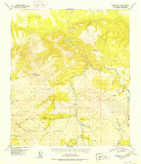
1952 · Fairbanks A-4
USGS Topo · 1:63,360