
1950 Map of Fairbanks A-4
USGS Topo · Published 1964About this map
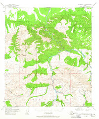
Rex Dome and the surrounding interior Alaska wilderness are documented here just as the territory was transitioning into statehood. The map reveals a landscape defined by its mineral potential and seasonal accessibility, centered on the Tatlanika River and its numerous tributaries. Early mining interests are clearly visible at the Liberty Bell Mine and a Placer Mine near Fourth of July Creek, reflecting the rugged industrial activity that drove exploration in this region. Evidence of the area's isolation and reliance on bush aviation is present through features like the Landing Strip (Aban'd) and various Cabin sites. The transportation network is limited to a Winter Trail, underscoring the seasonal nature of travel across the drainages of California Creek and Rex Creek. This 1950s data, updated in the early 1960s, provides an essential record of the interior's topography before more modern development reached these remote drainages.
Find a feature on this map
32 named features on this map. Tap any name to fly to it.
Don’t see what you’re looking for? This feature index may not catch every label — zoom into the map to look around manually.
Map Details
Editions of this 1950 Fairbanks A-4 Map
4 editions found
Other maps of this area

1949 · Fairbanks B-5
USGS Topo · 1:63,360

1949 · Fairbanks B-4
USGS Topo · 1:63,360

1949 · Fairbanks B-3
USGS Topo · 1:63,360

1950 · Fairbanks
USGS Topo · 1:250,000

1950 · Fairbanks A-5
USGS Topo · 1:63,360

1950 · Healy D-4
USGS Topo · 1:63,360

1950 · Fairbanks A-3
USGS Topo · 1:63,360

1950 · Healy D-3
USGS Topo · 1:63,360

1950 · Fairbanks B-5
USGS Topo · 1:63,360

1951 · Healy
USGS Topo · 1:250,000