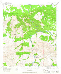
1950 Map of Fairbanks A-4
USGS Topo · Published 1965About this map
Liberty Bell Mine and various extractive operations define this mid-century landscape in the Alaskan interior. The terrain is dominated by the Tatlanika River and Wood River systems, where numerous waterways like California Creek, Bonanza Creek, and Marguerite Creek carve through the high elevations of Rex Dome and Vabm Rex 4160. Evidence of remote industry and transport is clear, with a Placer Mine situated near Coal Creek and aviation infrastructure including a Landing Strip and a Landing Strip (Aban'd).
Find a feature on this map
35 named features on this map. Tap any name to fly to it.
Don’t see what you’re looking for? This feature index may not catch every label — zoom into the map to look around manually.
Map Details
Editions of this 1950 Fairbanks A-4 Map
4 editions found
Other maps of this area

1949 · Fairbanks B-5
USGS Topo · 1:63,360

1949 · Fairbanks B-4
USGS Topo · 1:63,360

1949 · Fairbanks B-3
USGS Topo · 1:63,360

1950 · Fairbanks
USGS Topo · 1:250,000

1950 · Fairbanks A-5
USGS Topo · 1:63,360

1950 · Healy D-4
USGS Topo · 1:63,360

1950 · Fairbanks A-4
USGS Topo · 1:63,360

1950 · Fairbanks A-3
USGS Topo · 1:63,360

1950 · Healy D-3
USGS Topo · 1:63,360

1950 · Fairbanks B-5
USGS Topo · 1:63,360