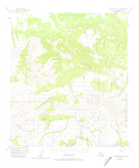
1950 Map of Fairbanks A-4
USGS Topo · Published 1974About this map
Tatlanika River drainage dominates this interior landscape, revealing a remote terrain defined by early resource extraction and seasonal travel. The presence of the Liberty Bell Mine and a Placer Mine near Wilson Creek indicates the region's mining activity during the mid-20th century, supported by basic aviation infrastructure like the Landing Strip near Iron Creek and a Landing Strip (Aban'd) further east. A lengthy Winter Trail cuts across the northern ridges, illustrating how the area was navigated when the ground was frozen, bypassing the steep grades near Rex Dome. The intricate network of family-named or prospector-named waterways, such as Emma Creek, Bonanza Creek, and Homestake Creek, points to a history of individual claims and small-scale operations across the hills south of the Tatlanika River's main course.
Find a feature on this map
32 named features on this map. Tap any name to fly to it.
Don’t see what you’re looking for? This feature index may not catch every label — zoom into the map to look around manually.
Map Details
Editions of this 1950 Fairbanks A-4 Map
4 editions found
Other maps of this area

1949 · Fairbanks B-5
USGS Topo · 1:63,360

1949 · Fairbanks B-4
USGS Topo · 1:63,360

1949 · Fairbanks B-3
USGS Topo · 1:63,360

1950 · Fairbanks
USGS Topo · 1:250,000

1950 · Fairbanks A-5
USGS Topo · 1:63,360

1950 · Healy D-4
USGS Topo · 1:63,360

1950 · Fairbanks A-4
USGS Topo · 1:63,360

1950 · Fairbanks A-3
USGS Topo · 1:63,360

1950 · Healy D-3
USGS Topo · 1:63,360

1950 · Fairbanks B-5
USGS Topo · 1:63,360