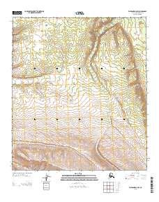
2013 Map of Fairbanks A-5 SW
USGS Topo · Published 2013About this map
Bear Creek and its southern tributary Bear Cr carve a significant north-south drainage through this portion of the Fairbanks A-5 SW quadrangle. The terrain is characterized by a series of high ridges and deep valleys, typical of the interior Alaskan wilderness before reaching the higher peaks of the Alaska Range. In the northeastern corner, the headwaters of June Cr emerge, while the land to the west transitions across the boundary of Range 9 West and Range 10 West. This 2013 survey illustrates the drainage patterns and topographic relief of a largely undeveloped landscape, where the shifting elevations between Township 9 South and Township 10 South define the movement of water across this remote borough.
Find a feature on this map
5 named features on this map. Tap any name to fly to it.
Don’t see what you’re looking for? This feature index may not catch every label — zoom into the map to look around manually.
Map Details
Editions of this 2013 Fairbanks A-5 SW Map
This is the sole edition of this map. No revisions or reprints were ever made.
Other maps of this area

1950 · Fairbanks
USGS Topo · 1:250,000

1950 · Fairbanks A-5
USGS Topo · 1:63,360

1951 · Healy
USGS Topo · 1:250,000

1951 · Fairbanks
USGS Topo · 1:250,000

1951 · Fairbanks A-5
USGS Topo · 1:63,360

1951 · Healy D-6
USGS Topo · 1:63,360

1951 · Healy D-5
USGS Topo · 1:63,360

1952 · Healy D-5
USGS Topo · 1:63,360

1952 · Fairbanks A-6
USGS Topo · 1:63,360

1952 · Fairbanks
USGS Topo · 1:250,000