
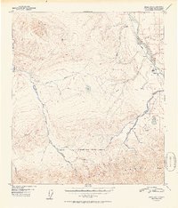
1952 Map of Healy D-5
USGS Topo · Published 1952About this map
Mt McKinley National Park and the northern slopes of the Alaska Range dominate this mid-century survey, revealing a landscape defined by the convergence of high-altitude terrain and industrial extraction. The Alaska Railroad tracks follow the corridor of the Nenana River, providing the essential link for the Lignite settlement and the nearby Diamond Coal Mine. The map documents a transition from the wilderness of the park interior—marked by the Savage River and a remote Ranger Cabin—to the emerging infrastructure of the Nenana valley, including a small Airstrip and several miles of Tractor Trail.
Find a feature on this map
31 named features on this map. Tap any name to fly to it.
Don’t see what you’re looking for? This feature index may not catch every label — zoom into the map to look around manually.
Map Details
Editions of this 1952 Healy D-5 Map
2 editions found
Other maps of this area

1950 · Fairbanks
USGS Topo · 1:250,000

1950 · Fairbanks A-5
USGS Topo · 1:63,360

1950 · Healy D-4
USGS Topo · 1:63,360

1950 · Healy C-4
USGS Topo · 1:63,360

1950 · Fairbanks A-4
USGS Topo · 1:63,360

1951 · Healy
USGS Topo · 1:250,000

1951 · Fairbanks
USGS Topo · 1:250,000

1951 · Fairbanks A-5
USGS Topo · 1:63,360

1951 · Healy D-6
USGS Topo · 1:63,360

1951 · Healy D-5
USGS Topo · 1:63,360