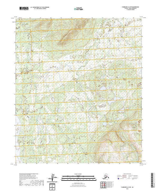
2024 Map of Fairbanks A-6 NW
USGS Topo · Published 2024About this map
The Toklat River and the Sushana River carve their paths through this stretch of Denali, defining a landscape dominated by the low-lying Totek Hills. This map documents a vast expanse of wetlands and riverine systems where water dictates the shape of the terrain. The presence of the Totek Hills in the northern portion of the quadrangle provides a subtle topographic rise above the surrounding braided river channels and saturated flats. These hydrological features represent the complex drainage patterns inherent to the region, offering a clear record of the local geography as it existed in 2024. The map serves as a detailed spatial reference for the intricate network of channels and high ground within this remote Alaskan environment.
Find a feature on this map
8 named features on this map. Tap any name to fly to it.
Don’t see what you’re looking for? This feature index may not catch every label — zoom into the map to look around manually.
Map Details
Editions of this 2024 Fairbanks A-6 NW Map
This is the sole edition of this map. No revisions or reprints were ever made.
Other maps of this area

1948 · Kantishna River
USGS Topo · 1:250,000

1950 · Fairbanks
USGS Topo · 1:250,000

1951 · Kantishna River
USGS Topo · 1:250,000

1951 · Fairbanks
USGS Topo · 1:250,000

1952 · Fairbanks A-6
USGS Topo · 1:63,360

1952 · Kantishna River A-1
USGS Topo · 1:63,360

1952 · Kantishna River
USGS Topo · 1:250,000

1952 · Kantishna River B-1
USGS Topo · 1:63,360

1952 · Fairbanks
USGS Topo · 1:250,000
1953 · Fairbanks B-6
USGS Topo · 1:63,360