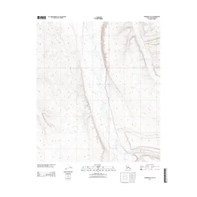
2013 Map of Fairbanks A-6 SE
USGS Topo · Published 2013About this map
Teklanika River dominates the central valley of this topographic study, flowing through the vast Interior landscape of the Denali region. This 2013 survey provides a detailed visualization of the river's braided path as it moves northward through the glacial-carved terrain. The map is defined by its precise ten-foot contour intervals, which trace the intricate landforms and ridges flanking the waterway. Located within the Public Land Survey System designations of Townships 9 and 10 South and Ranges 10 and 11 West, the area reflects a pristine wilderness environment where the natural drainage patterns of the river system are the primary geographic features. It serves as a modern record of the fluvial geomorphology in this part of the Alaska-Denali Borough.
Find a feature on this map
3 named features on this map. Tap any name to fly to it.
Don’t see what you’re looking for? This feature index may not catch every label — zoom into the map to look around manually.
Map Details
Editions of this 2013 Fairbanks A-6 SE Map
This is the sole edition of this map. No revisions or reprints were ever made.
Other maps of this area

1950 · Fairbanks
USGS Topo · 1:250,000

1950 · Fairbanks A-5
USGS Topo · 1:63,360

1951 · Healy
USGS Topo · 1:250,000

1951 · Fairbanks
USGS Topo · 1:250,000

1951 · Fairbanks A-5
USGS Topo · 1:63,360

1951 · Healy D-6
USGS Topo · 1:63,360

1951 · Healy D-5
USGS Topo · 1:63,360

1952 · Healy D-5
USGS Topo · 1:63,360

1952 · Fairbanks A-6
USGS Topo · 1:63,360

1952 · Fairbanks
USGS Topo · 1:250,000