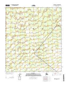
2013 Map of Fairbanks B-2 NW
USGS Topo · Published 2013About this map
Willow Cr dominates the central drainage of this interior Alaskan landscape within the Fairbanks North Star Borough. The terrain is defined by the winding paths of Willow Cr and Crooked Cr, which move through a series of valleys as part of the broader watershed system. This 2013 survey illustrates the land's surveyor-defined structure, marked by the intersection of townships T 5 S and T 6 S with ranges R 1 W and R 2 W. The lack of mapped roads or settlements emphasizes the undeveloped character of this specific sector of the Fairbanks B-2 NW quadrangle, preserving the natural flow of the local creek systems as they appeared in the early 21st century.
Find a feature on this map
4 named features on this map. Tap any name to fly to it.
Don’t see what you’re looking for? This feature index may not catch every label — zoom into the map to look around manually.
Map Details
Editions of this 2013 Fairbanks B-2 NW Map
This is the sole edition of this map. No revisions or reprints were ever made.
Other maps of this area

1949 · Fairbanks C-2
USGS Topo · 1:63,360

1949 · Fairbanks B-3
USGS Topo · 1:63,360

1950 · Fairbanks
USGS Topo · 1:250,000

1950 · Fairbanks C-3
USGS Topo · 1:63,360

1950 · Fairbanks B-2
USGS Topo · 1:63,360
1951 · Fairbanks B-2
USGS Topo · 1:63,360

1951 · Fairbanks
USGS Topo · 1:250,000

1952 · Fairbanks C-2
USGS Topo · 1:63,360
1952 · Fairbanks B-3
USGS Topo · 1:63,360
1952 · Fairbanks C-3
USGS Topo · 1:63,360