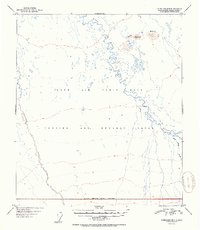
1952 Map of Fairbanks B-3
USGS Topo · Published 1952About this map
Ladd Air Force Base occupies a significant portion of this interior Alaskan landscape, reflecting the mid-century expansion of military aviation and strategic defense operations. The terrain is dominated by the complex, meandering path of the Wood River, which snakes through the northern and eastern sections of the quadrangle. South of the river, the landscape is designated as a Bombing and Gunnery Range, defined by an approximate military reservation boundary that segments the wilderness for training purposes.
Find a feature on this map
10 named features on this map. Tap any name to fly to it.
Don’t see what you’re looking for? This feature index may not catch every label — zoom into the map to look around manually.
Map Details
Editions of this 1952 Fairbanks B-3 Map
2 editions found
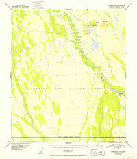
Other maps of this area

1949 · Fairbanks C-2
USGS Topo · 1:63,360

1949 · Fairbanks B-4
USGS Topo · 1:63,360

1949 · Fairbanks B-3
USGS Topo · 1:63,360

1949 · Fairbanks A-2
USGS Topo · 1:63,360

1950 · Fairbanks
USGS Topo · 1:250,000

1950 · Fairbanks C-3
USGS Topo · 1:63,360

1950 · Fairbanks C-4
USGS Topo · 1:63,360

1950 · Fairbanks A-4
USGS Topo · 1:63,360

1950 · Fairbanks A-3
USGS Topo · 1:63,360

1950 · Fairbanks B-2
USGS Topo · 1:63,360