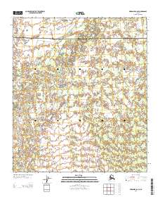
2013 Map of Fairbanks B-6 SE
USGS Topo · Published 2013About this map
The Teklanika River meanders through this portion of the Alaskan interior, serving as the primary geographical focal point for a landscape defined by its intricate drainage patterns. The map documents the political boundary between Yukon-Koyukuk and Denali, a line that cuts across the northern section of the quadrangle. This 2013 survey illustrates the complex, braided nature of the river valley and the myriad small ponds and wetlands that characterize the local terrain. The lack of named roads or settlements underscores the wilderness character of this region, where the hydrology of the Teklanika River remains the dominant influence on the land. Researchers and map collectors can use this sheet to trace the exact course of the river and the township and range lines that organize this vast territory.
Find a feature on this map
5 named features on this map. Tap any name to fly to it.
Don’t see what you’re looking for? This feature index may not catch every label — zoom into the map to look around manually.
Map Details
Editions of this 2013 Fairbanks B-6 SE Map
This is the sole edition of this map. No revisions or reprints were ever made.
Other maps of this area

1949 · Fairbanks B-5
USGS Topo · 1:63,360

1950 · Fairbanks
USGS Topo · 1:250,000

1950 · Fairbanks A-5
USGS Topo · 1:63,360

1950 · Fairbanks B-5
USGS Topo · 1:63,360

1951 · Fairbanks B-5
USGS Topo · 1:63,360

1951 · Fairbanks
USGS Topo · 1:250,000

1951 · Fairbanks A-5
USGS Topo · 1:63,360

1952 · Fairbanks A-6
USGS Topo · 1:63,360

1952 · Fairbanks
USGS Topo · 1:250,000
1953 · Fairbanks B-6
USGS Topo · 1:63,360