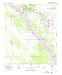
1950 Map of Fairbanks C-1
USGS Topo · Published 1978About this map
Eielson Air Force Base dominates the eastern landscape of this interior Alaska survey, which records a complex network of waterways and military installations during the mid-20th century. The braided channels of the Tanana River carve a wide path through the center of the sheet, flanked by extensive tracts of the Fort Wainwright Military Reservation and the Dyke Range Military Reservation. These massive land holdings illustrate the Cold War strategic importance of the region near Fairbanks.
Find a feature on this map
18 named features on this map. Tap any name to fly to it.
Don’t see what you’re looking for? This feature index may not catch every label — zoom into the map to look around manually.
Map Details
Editions of this 1950 Fairbanks C-1 Map
4 editions found
Other maps of this area

1949 · Fairbanks D-1
USGS Topo · 1:62,500

1949 · Fairbanks D-2
USGS Topo · 1:62,500

1949 · Big Delta B-6
USGS Topo · 1:63,360

1949 · Fairbanks C-1
USGS Topo · 1:63,360

1949 · Big Delta C-6
USGS Topo · 1:63,360

1949 · Fairbanks C-2
USGS Topo · 1:63,360

1950 · Fairbanks
USGS Topo · 1:250,000

1950 · Big Delta
USGS Topo · 1:250,000

1950 · Big Delta D-6
USGS Topo · 1:63,360

1950 · Fairbanks C-1
USGS Topo · 1:63,360