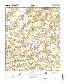
2013 Map of Fairbanks C-2 SW
USGS Topo · Published 2013About this map
Bonnifield Trl cuts through a landscape defined by meandering watercourses and wetlands in this portion of the Fairbanks North Star Borough. The terrain is shaped by the presence of Willow Cr, which winds extensively across the township lines, while Clear Cr touches the northeastern corner of the sheet. The persistence of the Bonnifield Trl highlights a historical corridor through the interior, offering a look at the transport patterns that predate more modern developments in the Tanana Valley region. This 2013 survey provides a clear view of the hydrography and public land survey system lines that organize this stretch of the Alaska interior.
Find a feature on this map
6 named features on this map. Tap any name to fly to it.
Don’t see what you’re looking for? This feature index may not catch every label — zoom into the map to look around manually.
Map Details
Editions of this 2013 Fairbanks C-2 SW Map
This is the sole edition of this map. No revisions or reprints were ever made.
Other maps of this area

1949 · Fairbanks C-2
USGS Topo · 1:63,360

1949 · Fairbanks B-3
USGS Topo · 1:63,360

1950 · Fairbanks
USGS Topo · 1:250,000

1950 · Fairbanks C-3
USGS Topo · 1:63,360

1950 · Fairbanks B-2
USGS Topo · 1:63,360
1951 · Fairbanks B-2
USGS Topo · 1:63,360

1951 · Fairbanks
USGS Topo · 1:250,000

1952 · Fairbanks C-2
USGS Topo · 1:63,360
1952 · Fairbanks B-3
USGS Topo · 1:63,360
1952 · Fairbanks C-3
USGS Topo · 1:63,360