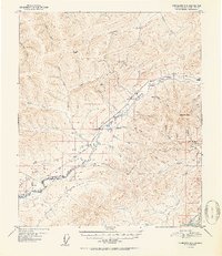
1952 Map of Fairbanks D-3
USGS Topo · Published 1952About this map
Murphy Dome and the surrounding interior ridges define the landscape of this 1952 survey, which documents the mining and transportation infrastructure of the Fairbanks region. The Alaska Railroad cuts through the central valley, flanked by small settlements such as Old Saulich and Saulich. Transportation across this terrain relied on specialized routes, including a Sled Road and a Tractor Trail, reflecting the logistical realities of Alaskan geography before modern highway expansion. A concentration of gold-era activity is evident near Ester Dome, where a Mine is identified on the slopes above Ester Creek. The northern reaches of the map follow the meandering Goldstream Creek, while the southern edge is anchored by the braided channels of the Tanana River, showing the importance of these waterways and rail spurs like the Dome Spur for reaching remote camps.
Find a feature on this map
50 named features on this map. Tap any name to fly to it.
Don’t see what you’re looking for? This feature index may not catch every label — zoom into the map to look around manually.
Map Details
Editions of this 1952 Fairbanks D-3 Map
2 editions found

Other maps of this area

1945 · Livengood
USGS Topo · 1:250,000

1949 · Fairbanks D-2
USGS Topo · 1:62,500

1949 · Fairbanks D-3
USGS Topo · 1:63,360

1949 · Fairbanks D-4
USGS Topo · 1:63,360

1949 · Fairbanks C-2
USGS Topo · 1:63,360

1950 · Fairbanks
USGS Topo · 1:250,000

1950 · Fairbanks C-3
USGS Topo · 1:63,360

1950 · Fairbanks C-4
USGS Topo · 1:63,360

1950 · Fairbanks D-3
USGS Topo · 1:63,360

1951 · Fairbanks
USGS Topo · 1:250,000