
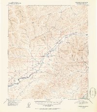
1952 Map of Fairbanks D-3
USGS Topo · Published 1952About this map
The Alaska Railroad serves as the industrial spine of this interior Alaskan landscape, winding alongside Goldstream Creek through a series of small trackside points. The rail line connects the minor settlements of Saulich, Old Saulich, and Martin, providing a critical link for the gold-bearing drainages of the region. Steep ridges rise sharply from the valley floor, capped by the prominent peaks of Murphy Dome and Ester Dome, while the Fairbanks Base Line cuts a surveyor's path across the center of the sheet.
Find a feature on this map
51 named features on this map. Tap any name to fly to it.
Don’t see what you’re looking for? This feature index may not catch every label — zoom into the map to look around manually.
Map Details
Editions of this 1952 Fairbanks D-3 Map
2 editions found
Other maps of this area

1945 · Livengood
USGS Topo · 1:250,000

1949 · Fairbanks D-2
USGS Topo · 1:62,500

1949 · Fairbanks D-3
USGS Topo · 1:63,360

1949 · Fairbanks D-4
USGS Topo · 1:63,360

1949 · Fairbanks C-2
USGS Topo · 1:63,360

1950 · Fairbanks
USGS Topo · 1:250,000

1950 · Fairbanks C-3
USGS Topo · 1:63,360

1950 · Fairbanks C-4
USGS Topo · 1:63,360

1950 · Fairbanks D-3
USGS Topo · 1:63,360

1951 · Fairbanks
USGS Topo · 1:250,000