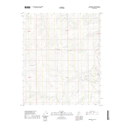
2021 Map of Fairbanks D-3 NW
USGS Topo · Published 2021About this map
Murphy Dome anchors this high-latitude terrain northwest of Fairbanks, where the drainage network of the Yukon-Tanana Uplands dictates the path of local infrastructure. A complex system of interior waterways, including Murphy Cr, Keystone Cr, and Fortune Cr, carves through the landscape, feeding eventually toward the broader valley systems. The road network reflects the logistical challenges of the subarctic, with Murphy Dome Road and its extension providing primary access across the high ground. To the southeast, a concentration of named thoroughfares like Reconstruction Road, Seward Road, and Emancipation Lane suggests a more recent corridor of activity or development along the Cache Creek drainage. This modern 2021 survey illustrates how contemporary surveying methods reconcile the wilderness of t2n r4w with the increasing reach of the Fairbanks North Star Borough.
Find a feature on this map
27 named features on this map. Tap any name to fly to it.
Don’t see what you’re looking for? This feature index may not catch every label — zoom into the map to look around manually.
Map Details
Editions of this 2021 Fairbanks D-3 NW Map
This is the sole edition of this map. No revisions or reprints were ever made.
Other maps of this area

1945 · Livengood
USGS Topo · 1:250,000

1949 · Fairbanks D-3
USGS Topo · 1:63,360

1949 · Fairbanks D-4
USGS Topo · 1:63,360

1950 · Fairbanks
USGS Topo · 1:250,000

1950 · Fairbanks D-3
USGS Topo · 1:63,360

1951 · Fairbanks
USGS Topo · 1:250,000

1951 · Livengood
USGS Topo · 1:250,000

1951 · Livengood A-4
USGS Topo · 1:63,360

1952 · Fairbanks D-3
USGS Topo · 1:63,360

1952 · Fairbanks D-4
USGS Topo · 1:63,360