
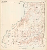
1952 Map of Fairbanks
USGS Topo · Published 1953About this map
Fairbanks serves as the primary hub in this early 1950s survey of western Sullivan County, Indiana, where the rural landscape meets the winding course of the Wabash River. The map captures a transition between the elevated river bluffs and the lower bottomlands, featuring landforms like Ladd Hill and ancient earthworks identified as Indian Mound and Indian Mounds. The transport network of the era is well-defined, including historically significant routes such as Old Kentucky Road, Kentucky Road, and the Harrison Trail.
Find a feature on this map
32 named features on this map. Tap any name to fly to it.
Don’t see what you’re looking for? This feature index may not catch every label — zoom into the map to look around manually.
Map Details
Editions of this 1952 Fairbanks Map
2 editions found
Other maps of this area

1932 · Marshall
USGS Topo · 1:62,500

1937 · Marshall
USGS Topo · 1:62,500

1940 · Pimento
USGS Topo · 1:24,000

1942 · Fairbanks
USGS Topo · 1:24,000

1942 · Shelburn
USGS Topo · 1:24,000

1942 · Hutton
USGS Topo · 1:24,000

1943 · Merom
USGS Topo · 1:24,000

1943 · Sullivan
USGS Topo · 1:24,000

1952 · Shelburn
USGS Topo · 1:24,000
1952 · Hutton
USGS Topo · 1:24,000