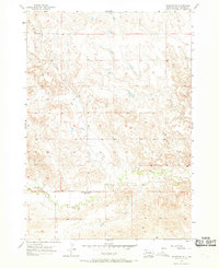
1957 Map of Fairburn NE
USGS Topo · Published 1969About this map
French Creek Sch stands as a quiet marker of early rural education in Custer County during the mid-1950s. This survey, conducted by the Geological Survey, details a landscape deeply etched by seasonal drainage patterns and traditional land boundaries. The map traces the winding course of French Creek as it moves through the southern sections, joined by the South Fork and various intermittent channels. The terrain is defined by rugged draws and seasonal watercourses, including Dry Creek, Sheep Camp Draw, and Shorty Draw, which illustrate the complex hydrology of the South Dakota plains. These features, combined with the township and range lines such as T. 4 S. T. 5 S. and R. 8 E. R. 9 E., provide a clear view of the ranching and agricultural framework that shaped the area's development before more modern infrastructure arrived.
Find a feature on this map
9 named features on this map. Tap any name to fly to it.
Don’t see what you’re looking for? This feature index may not catch every label — zoom into the map to look around manually.
Map Details
Editions of this 1957 Fairburn NE Map
2 editions found
Other maps of this area

1894 · Hermosa
USGS Topo · 1:125,000

1901 · Hermosa
USGS Topo · 1:125,000

1951 · Fairburn SE
USGS Topo · 1:24,000

1951 · Red Shirt
USGS Topo · 1:24,000

1951 · Red Shirt SW
USGS Topo · 1:24,000

1953 · Hermosa
USGS Topo · 1:24,000

1953 · Hermosa SE
USGS Topo · 1:24,000

1953 · Caputa SW
USGS Topo · 1:24,000

1955 · Hot Springs
USGS Topo · 1:250,000
1957 · Fairburn NE
USGS Topo · 1:24,000