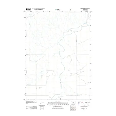
2012 Map of Fairburn SE
USGS Topo · Published 2012About this map
Cheyenne River dominates the drainage of this South Dakota landscape, winding through a network of creeks and draws. The terrain is defined by broad geographic landmarks such as Harrison Flat and the deep incisions of Spring Canyon. Local transport is facilitated by a grid of named rural routes, including the Cottonwood Cutoff and Riverside Rd, which navigate the elevation changes near the water bodies. Smaller tributaries like S Fork French Cr and Cottonwood Creek feed into the primary river system, illustrating the hydrology of Oglala Lakota County as recorded in the early 21st century. The map provides a clear picture of the modern road network, where Sage Rd and various county highways link the open plains to the river valleys.
Find a feature on this map
13 named features on this map. Tap any name to fly to it.
Don’t see what you’re looking for? This feature index may not catch every label — zoom into the map to look around manually.
Map Details
Editions of this 2012 Fairburn SE Map
This is the sole edition of this map. No revisions or reprints were ever made.
Other maps of this area

1894 · Hermosa
USGS Topo · 1:125,000

1896 · Oelrichs
USGS Topo · 1:125,000

1900 · Oelrichs
USGS Topo · 1:125,000

1901 · Hermosa
USGS Topo · 1:125,000

1951 · Fairburn SE
USGS Topo · 1:24,000

1951 · Red Shirt
USGS Topo · 1:24,000

1951 · Willow Creek NW
USGS Topo · 1:24,000

1951 · Red Shirt SW
USGS Topo · 1:24,000

1951 · Smithwick NE
USGS Topo · 1:24,000

1951 · Smithwick NW
USGS Topo · 1:24,000