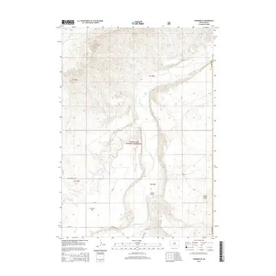
2015 Map of Fairburn SE
USGS Topo · Published 2015About this map
Buffalo Gap National Grassland dominates this South Dakota landscape, where the Cheyenne River carves a winding path through the prairie. The terrain is defined by distinct plateau and canyon formations, including the prominent Squaw-Humper Table to the east and the deeply incised Spring Canyon. These natural features overlook broad alluvial areas such as Harrison Flat, illustrating the erosional power of the river system over time.
Find a feature on this map
20 named features on this map. Tap any name to fly to it.
Don’t see what you’re looking for? This feature index may not catch every label — zoom into the map to look around manually.
Map Details
Editions of this 2015 Fairburn SE Map
This is the sole edition of this map. No revisions or reprints were ever made.
Other maps of this area

1894 · Hermosa
USGS Topo · 1:125,000

1896 · Oelrichs
USGS Topo · 1:125,000

1900 · Oelrichs
USGS Topo · 1:125,000

1901 · Hermosa
USGS Topo · 1:125,000

1951 · Fairburn SE
USGS Topo · 1:24,000

1951 · Red Shirt
USGS Topo · 1:24,000

1951 · Willow Creek NW
USGS Topo · 1:24,000

1951 · Red Shirt SW
USGS Topo · 1:24,000

1951 · Smithwick NE
USGS Topo · 1:24,000

1951 · Smithwick NW
USGS Topo · 1:24,000