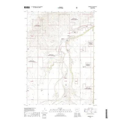
2017 Map of Fairburn SE
USGS Topo · Published 2017About this map
Buffalo Gap National Grassland dominates the landscape in this section of Oglala Lakota County, where the topography is defined by the winding course of the Cheyenne River. This environment is characterized by wide alluvial plains and dissected plateaus, including the prominent Harrison Flat to the southwest. The presence of Tahc'a Okute Aglehan provides a rare named cultural point of interest amidst the expansive public lands. The river and its tributaries, such as Cottonwood Cr and S Fork French Cr, create a complex network of drainages that have historically dictated movement and land use across this part of the plains. Along the eastern edge, Spring Canyon cuts through the terrain, illustrating the gradual erosion of the prairie shelf. Local transport is represented by several county routes and rural paths like Riverside Rd, which follow the natural contours of the river valleys.
Find a feature on this map
20 named features on this map. Tap any name to fly to it.
Don’t see what you’re looking for? This feature index may not catch every label — zoom into the map to look around manually.
Map Details
Editions of this 2017 Fairburn SE Map
This is the sole edition of this map. No revisions or reprints were ever made.
Other maps of this area

1894 · Hermosa
USGS Topo · 1:125,000

1896 · Oelrichs
USGS Topo · 1:125,000

1900 · Oelrichs
USGS Topo · 1:125,000

1901 · Hermosa
USGS Topo · 1:125,000

1951 · Fairburn SE
USGS Topo · 1:24,000

1951 · Red Shirt
USGS Topo · 1:24,000

1951 · Willow Creek NW
USGS Topo · 1:24,000

1951 · Red Shirt SW
USGS Topo · 1:24,000

1951 · Smithwick NE
USGS Topo · 1:24,000

1951 · Smithwick NW
USGS Topo · 1:24,000