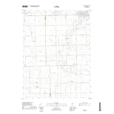
2018 Map of Fairbury
USGS Topo · Published 2018About this map
Fairbury anchors the northeastern corner of this modern topographic study, showing a structured grid of residential streets and civic sites such as Graceland Cem. The landscape outside the town center is dominated by an extensive network of rural roads, including Co Hwy 22 and Co Hwy 8, which divide the terrain into large agricultural blocks. Small, family and church-affiliated burial grounds are scattered throughout the countryside, such as Spence Cem and the Immanuel Lutheran Church Cem, providing critical touchpoints for local genealogical research. To the northwest, the small community of Weston is situated near Weston Cem. The natural drainage of the region is defined by the winding paths of Indian Creek and Rooks Cr, which cut through the otherwise orderly township and range system of this Central Illinois prairie.
Find a feature on this map
78 named features on this map. Tap any name to fly to it.
Don’t see what you’re looking for? This feature index may not catch every label — zoom into the map to look around manually.
Map Details
Editions of this 2018 Fairbury Map
This is the sole edition of this map. No revisions or reprints were ever made.
Other maps of this area

1935 · Pontiac
USGS Topo · 1:62,500

1939 · Pontiac
USGS Topo · 1:62,500

1947 · Sibley
USGS Topo · 1:62,500

1947 · Cullom
USGS Topo · 1:62,500

1949 · Cullom
USGS Topo · 1:62,500

1949 · Sibley
USGS Topo · 1:62,500

1957 · Colfax
USGS Topo · 1:62,500

1958 · Peoria
USGS Topo · 1:250,000

1961 · Peoria
USGS Topo · 1:250,000

1963 · Peoria
USGS Topo · 1:250,000