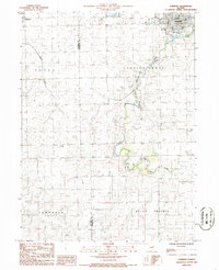
1986 Map of Fairbury
USGS Topo · Published 1986About this map
Fairbury serves as the primary municipal hub in this portion of Livingston Co, positioned near the northern edge of the survey. The landscape transitions from the dense street grid of the town to the sprawling agricultural tracts of Indian Grove and Belle Prairie townships. A prominent Fairgrounds and a distinctive Round Bldg sit on the eastern outskirts of the city, while a Radio Tower marks the local skyline. The drainage patterns of Indian Creek and Roots Creek carve through the prairie, defining the natural topography of the region. To the west, the smaller settlement of Weston is situated near the McLean Co line. Small-scale industrial activity is evident at a local Quarry, while scattered Cem labels provide points of interest for genealogists tracing family locations across these rural townships.
Find a feature on this map
15 named features on this map. Tap any name to fly to it.
Don’t see what you’re looking for? This feature index may not catch every label — zoom into the map to look around manually.
Map Details
Editions of this 1986 Fairbury Map
This is the sole edition of this map. No revisions or reprints were ever made.
Other maps of this area

1935 · Pontiac
USGS Topo · 1:62,500

1939 · Pontiac
USGS Topo · 1:62,500

1947 · Sibley
USGS Topo · 1:62,500

1947 · Cullom
USGS Topo · 1:62,500

1949 · Cullom
USGS Topo · 1:62,500

1949 · Sibley
USGS Topo · 1:62,500

1957 · Colfax
USGS Topo · 1:62,500

1958 · Peoria
USGS Topo · 1:250,000

1961 · Peoria
USGS Topo · 1:250,000

1963 · Peoria
USGS Topo · 1:250,000