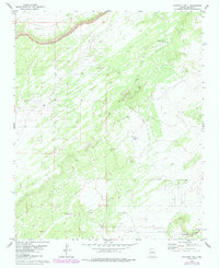
1979 Map of Fairchild Well
USGS Topo · Published 1985About this map
Petroglyphs located in the southeastern corner of this quadrangle suggest a long history of human presence in this high-desert environment of Apache County. The landscape is primarily defined by its intermittent water sources, which were critical for ranching operations in the late 1970s. The naming of the Fairchild Well, Bar-N Well, and Mesa Well indicates a dependence on groundwater to support activity across these townships. Hardscrabble Wash cuts across the southern terrain, providing a natural drainage corridor through the varying elevations. The presence of a Water Tank and several wells underscores the infrastructure required to sustain life and livestock in this arid portion of the Colorado Plateau. This survey, updated with 1980s aerial photography, provides a detailed record of the trails and water points used by local landholders during this era.
Find a feature on this map
10 named features on this map. Tap any name to fly to it.
Don’t see what you’re looking for? This feature index may not catch every label — zoom into the map to look around manually.
Map Details
Editions of this 1979 Fairchild Well Map
2 editions found
Other maps of this area

1886 · St Johns
USGS Topo · 1:250,000

1886 · Fort Defiance
USGS Topo · 1:250,000

1892 · Fort Defiance
USGS Topo · 1:250,000

1892 · St Johns
USGS Topo · 1:250,000

1954 · Saint Johns
USGS Topo · 1:250,000

1954 · Gallup
USGS Topo · 1:250,000

1957 · Saint Johns
USGS Topo · 1:250,000

1958 · Gallup
USGS Topo · 1:250,000

1958 · Saint Johns
USGS Topo · 1:250,000

1959 · Gallup
USGS Topo · 1:250,000