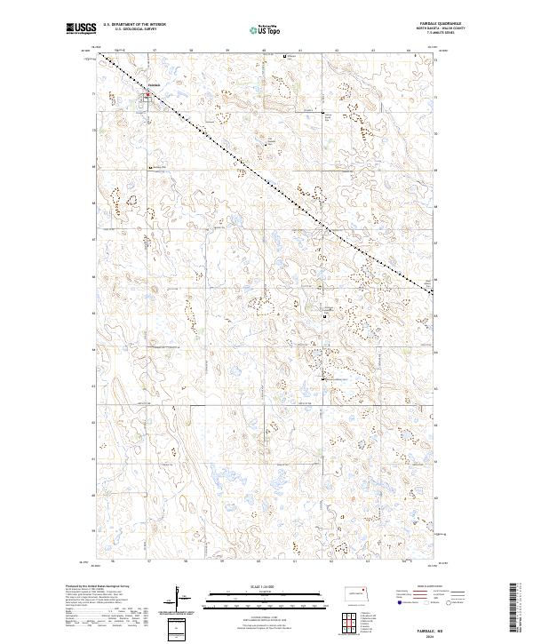
2024 Map of Fairdale
USGS Topo · Published 2024About this map
Fairdale anchors the northwest corner of this prairie landscape, serving as a primary settlement point amidst a grid of rural section lines and local roads like Co Hwy 22 and 75th St NE. The map reveals a high density of small, family-named burial grounds and historic church sites scattered across the township lines of t158n r59w and t158n r58w, including the Ohnstad Cem, Old Aadalen Cem, and the German Lutheran Cem. These small nodes, alongside the Hosna Burial Site, indicate a deeply rooted agricultural community where early pioneer families established local landmarks that persist today. Beyond the human footprint, conservation areas such as the Walsh County Waterfowl Production Area and the Walsh County WPA highlight the region's importance to migratory birds, marking the many small wetlands that dot the North Dakota plains.
Find a feature on this map
29 named features on this map. Tap any name to fly to it.
Don’t see what you’re looking for? This feature index may not catch every label — zoom into the map to look around manually.
Map Details
Editions of this 2024 Fairdale Map
This is the sole edition of this map. No revisions or reprints were ever made.
Other maps of this area

1953 · Devils Lake
USGS Topo · 1:250,000

1956 · Devils Lake
USGS Topo · 1:250,000

1972 · Nekoma
USGS Topo · 1:24,000

1972 · Osnabrock SW
USGS Topo · 1:24,000

1972 · Adams
USGS Topo · 1:24,000

1972 · Adams SW
USGS Topo · 1:24,000

1972 · Fairdale
USGS Topo · 1:24,000

1972 · Edmore NE
USGS Topo · 1:24,000

1972 · Lawton
USGS Topo · 1:24,000
1972 · Adams SE
USGS Topo · 1:24,000