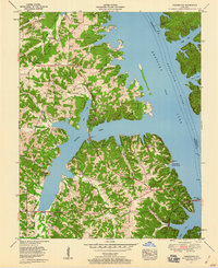
1955 Map of Fairdealing
USGS Topo · Published 1960About this map
The Tennessee River dominates the eastern landscape, having been transformed into the expansive Kentucky Lake following the construction of Kentucky Dam. This 1955 survey provides a clear view of the mid-century shoreline and the intricate network of inlets such as Jonathan Creek and Sugar Bay. Along the Jefferson Davis Highway, the community of Aurora serves as a gateway to the western shore, while the settlement of Fairdealing sits further inland.
Find a feature on this map
36 named features on this map. Tap any name to fly to it.
Don’t see what you’re looking for? This feature index may not catch every label — zoom into the map to look around manually.
Map Details
Editions of this 1955 Fairdealing Map
3 editions found
Other maps of this area

1936 · Mont
USGS Topo · 1:24,000

1936 · Fenton
USGS Topo · 1:24,000

1936 · Hardin
USGS Topo · 1:24,000

1936 · Hiatt
USGS Topo · 1:24,000

1936 · Benton
USGS Topo · 1:48,000

1936 · Birmingham
USGS Topo · 1:24,000

1936 · Golden Pond
USGS Topo · 1:48,000

1936 · Rushing
USGS Topo · 1:24,000

1936 · Dexter
USGS Topo · 1:24,000

1936 · Hico
USGS Topo · 1:24,000