
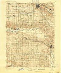
1903 Map of Fairfax
USGS Topo · Published 1903About this map
Cedar Rapids and Iowa City anchor this turn-of-the-century landscape, connected by a dense web of steam rail lines that defined Eastern Iowa's early development. The Chicago Rock Island and Pacific R.R. and several other trunk lines, including the Kansas City Line, strike across the prairie to service grain-heavy townships like Florence and Lenox. A distinctive cluster of communal settlements is visible in the west, including Amana, West Amana, High Amana, Middle Amana, and South Amana, situated along the winding course of the Iowa River.
Find a feature on this map
106 named features on this map. Tap any name to fly to it.
Don’t see what you’re looking for? This feature index may not catch every label — zoom into the map to look around manually.
Map Details
Editions of this 1903 Fairfax Map
2 editions found
Other maps of this area

1887 · Cedar Rapids
USGS Topo · 1:62,500

1888 · Shellsburg
USGS Topo · 1:62,500

1888 · Marion
USGS Topo · 1:62,500

1888 · Amana
USGS Topo · 1:62,500

1889 · Marion
USGS Topo · 1:62,500

1889 · Amana
USGS Topo · 1:62,500

1889 · Shellsburg
USGS Topo · 1:62,500

1890 · Anamosa
USGS Topo · 1:62,500

1891 · Oxford
USGS Topo · 1:62,500

1891 · Mechanicsville
USGS Topo · 1:62,500