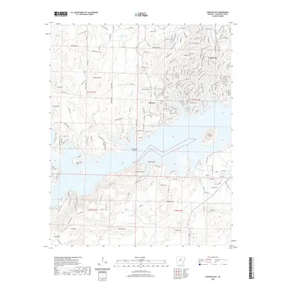
2020 Map of Fairfield Bay
USGS Topo · Published 2020About this map
Greers Ferry Lake dominates the central portion of this landscape, its complex shoreline creating numerous points and coves including Harpers Cove and Peter Rock Point. The resort community of Fairfield Bay is situated on the northern heights, characterized by a dense network of residential streets such as Lost Creek Pkwy and Mountain Ranch Dr. To the west lies the smaller settlement of Eglantine, positioned near the historic Eglantine Cem.
Find a feature on this map
217 named features on this map. Tap any name to fly to it.
Don’t see what you’re looking for? This feature index may not catch every label — zoom into the map to look around manually.
Map Details
Editions of this 2020 Fairfield Bay Map
This is the sole edition of this map. No revisions or reprints were ever made.
Other maps of this area

1892 · Mountain View
USGS Topo · 1:125,000

1894 · Mountain View
USGS Topo · 1:125,000

1956 · Russellville
USGS Topo · 1:250,000

1961 · Bee Branch
USGS Topo · 1:62,500

1961 · Bee Branch
USGS Topo · 1:24,000

1961 · Morganton
USGS Topo · 1:24,000

1963 · Quitman
USGS Topo · 1:24,000

1964 · Russellville
USGS Topo · 1:250,000
1973 · Fairfield Bay
USGS Topo · 1:24,000
1973 · Greers Ferry
USGS Topo · 1:24,000