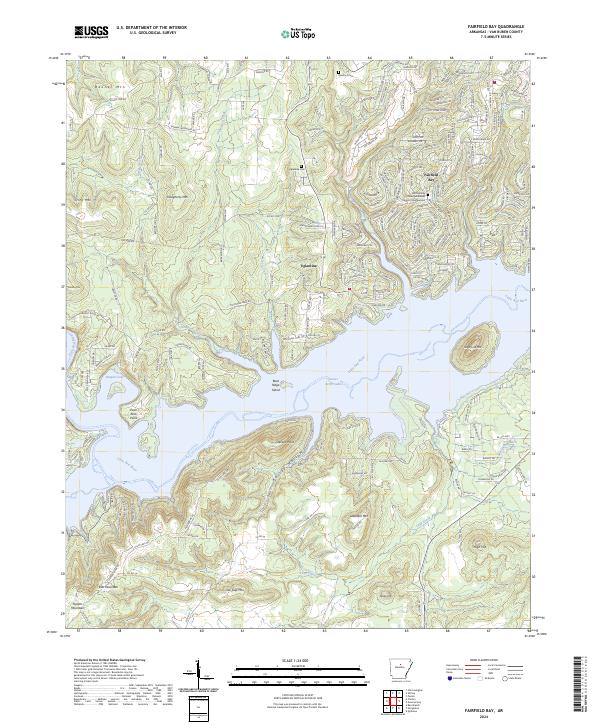
2024 Map of Fairfield Bay
USGS Topo · Published 2024About this map
Fairfield Bay dominates the northern reaches of Greers Ferry Lake, showcasing a landscape where modern development meets the irregular shoreline of the Little Red River valley. The map documents a residential network spanning from the lakefront up into the higher elevations of Banner Mtn and Story Mtn. While much of the area reflects contemporary recreational growth, historical markers persist in the form of the Eglantine Cem and Bradford Cem, which predate the more recent suburban street layouts. The topography is defined by prominent peaks and ridges, including Sugar Loaf Mtn and Dougherty Mtn, which frame the many coves and inlets like Harpers Cove. The community of Eglantine sits as a central point between the rugged upland terrain and the expansive waters of the reservoir, illustrating the transition from traditional Ozark settlements to a modern resort-oriented geography.
Find a feature on this map
60 named features on this map. Tap any name to fly to it.
Don’t see what you’re looking for? This feature index may not catch every label — zoom into the map to look around manually.
Map Details
Editions of this 2024 Fairfield Bay Map
This is the sole edition of this map. No revisions or reprints were ever made.
Other maps of this area

1892 · Mountain View
USGS Topo · 1:125,000

1894 · Mountain View
USGS Topo · 1:125,000

1956 · Russellville
USGS Topo · 1:250,000

1961 · Bee Branch
USGS Topo · 1:62,500

1961 · Bee Branch
USGS Topo · 1:24,000

1961 · Morganton
USGS Topo · 1:24,000

1963 · Quitman
USGS Topo · 1:24,000

1964 · Russellville
USGS Topo · 1:250,000
1973 · Fairfield Bay
USGS Topo · 1:24,000
1973 · Greers Ferry
USGS Topo · 1:24,000