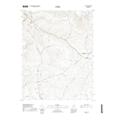
2019 Map of Fairfield
USGS Topo · Published 2019About this map
Fairfield sits at the intersection of Nelson and Spencer counties, serving as a hub for the agricultural lands and rolling drainages that define this part of Kentucky. The landscape is deeply carved by a network of waterways including the Salt River, Simpson Creek, and the winding Cox Creek. To the west, Highgrove marks the edge of Bullitt County, while Coxs Creek centers the southwestern portion of the map along the busy corridor of Louisville Rd. This modern survey reveals a countryside where historical family legacy remains visible through sites like Montgomery Cem and Saint Michaels Cem. The road network, from established routes like Fairfield Rd to winding paths like Irish Ridge Rd, follows the natural contours of the hills, illustrating how the physical geography continues to dictate settlement patterns even in the twenty-first century.
Find a feature on this map
74 named features on this map. Tap any name to fly to it.
Don’t see what you’re looking for? This feature index may not catch every label — zoom into the map to look around manually.
Map Details
Editions of this 2019 Fairfield Map
This is the sole edition of this map. No revisions or reprints were ever made.
Other maps of this area

1907 · Louisville
USGS Topo · 1:62,500

1929 · Taylorsville
USGS Topo · 1:62,500

1949 · Cravens
USGS Topo · 1:24,000

1949 · Samuels
USGS Topo · 1:24,000

1949 · Shepherdsville
USGS Topo · 1:62,500

1951 · Waterford
USGS Topo · 1:24,000

1951 · Mount Washington
USGS Topo · 1:24,000
1951 · Louisville
USGS Topo · 1:62,500

1953 · Maud
USGS Topo · 1:24,000

1953 · Bardstown
USGS Topo · 1:24,000