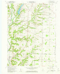
1960 Map of Fairfield
USGS Topo · Published 1962About this map
Whitewater State Park anchors the northern landscape of this Union County region, where the Whitewater Lake reservoir meets the winding East Fork Whitewater River. The 1960 revision captures a rural network of small settlements and family burial grounds, such as Old Bath Springs Cem and Fryer Cem, illustrating the deep-rooted community history of southeastern Indiana. Evidence of early infrastructure remains visible, most notably the Covered Bridge near Dunlapsville and the Baltimore and Ohio Railroad corridor passing through Lotus. Local industry and transit are further defined by a Gravel Pit and a prominent pipeline cutting across Harmony township. This topographic record preserves the layout of towns like Fairfield and Quakertown alongside numerous named drainage runs and creeks, reflecting the complex hydrology and agricultural organization of the mid-20th century.
Find a feature on this map
89 named features on this map. Tap any name to fly to it.
Don’t see what you’re looking for? This feature index may not catch every label — zoom into the map to look around manually.
Map Details
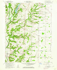
Editions of this 1960 Fairfield Map
2 editions found
Other maps of this area

1915 · College Corner
USGS Topo · 1:48,000

1915 · Harrison
USGS Topo · 1:48,000

1918 · College Corner
USGS Topo · 1:62,500

1948 · Fairfield
USGS Topo · 1:24,000

1953 · Cincinnati
USGS Topo · 1:250,000

1955 · Reily
USGS Topo · 1:24,000

1955 · Mount Carmel
USGS Topo · 1:24,000

1956 · Everton
USGS Topo · 1:24,000

1956 · Brownsville
USGS Topo · 1:24,000

1956 · Brookville
USGS Topo · 1:24,000