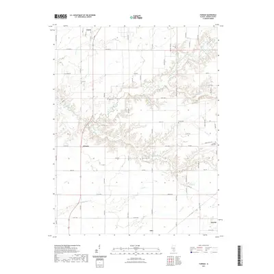
2021 Map of Fairman
USGS Topo · Published 2021About this map
Patoka and Odin anchor the north and south of this Marion County corridor, joined by the rural settlement of Fairman. The landscape is defined by the drainage of the Kaskaskia River and its numerous tributaries, including Davidson Cr and Louise Run, which carve through the central plains. For genealogists, the map preserves the exact locations of several community burial grounds, such as Cruse Cem, Lewis Cem, and the Cubbage Chapel Cem near the eastern border. The road network follows a rigid section-line grid typical of the Midwest, though the terrain around the East Fork Kaskaskia River introduces more varied topography and wetlands. This 2021 update documents the persisting rural character of the area, where small family-named cemeteries and narrow creek beds like Prairie Cr remain the primary landmarks between these historic Illinois towns.
Find a feature on this map
64 named features on this map. Tap any name to fly to it.
Don’t see what you’re looking for? This feature index may not catch every label — zoom into the map to look around manually.
Map Details
Editions of this 2021 Fairman Map
This is the sole edition of this map. No revisions or reprints were ever made.
Other maps of this area

1914 · Centralia
USGS Topo · 1:62,500

1934 · Salem
USGS Topo · 1:62,500

1935 · Centralia
USGS Topo · 1:62,500

1938 · Salem
USGS Topo · 1:62,500

1945 · Kinmundy
USGS Topo · 1:62,500

1945 · Vandalia
USGS Topo · 1:62,500

1947 · Vandalia
USGS Topo · 1:62,500

1947 · Kinmundy
USGS Topo · 1:62,500

1958 · Belleville
USGS Topo · 1:250,000

1962 · Belleville
USGS Topo · 1:250,000