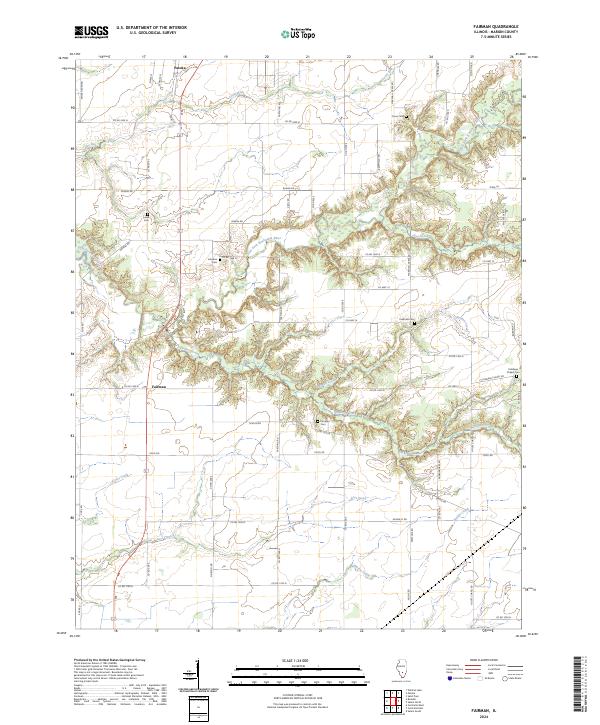
2024 Map of Fairman
USGS Topo · Published 2024About this map
The Patoka and Fairman area of Marion County is defined by a dense network of country roads and several family burial grounds scattered across the rural landscape. Significant genealogical sites are found throughout the quadrangle, including the Cruse Cem in the north and the Carrigan Cem and Cubbage Chapel Cem further south. The terrain is deeply carved by the East Fork Kaskaskia River, which is joined by numerous tributaries such as Louse Run, Jims Creek, and Barden Creek. These waterways create a series of bluffs and lowlands that dictate the placement of local homesteads and transportation routes like Co Rd 1600 N and Co Hwy 14. The southern reaches of the map transition into flatter drainage areas surrounding Lost Creek and Prairie Creek, illustrating the classic agricultural and riparian patterns of southern Illinois.
Find a feature on this map
62 named features on this map. Tap any name to fly to it.
Don’t see what you’re looking for? This feature index may not catch every label — zoom into the map to look around manually.
Map Details
Editions of this 2024 Fairman Map
This is the sole edition of this map. No revisions or reprints were ever made.
Other maps of this area

1914 · Centralia
USGS Topo · 1:62,500

1934 · Salem
USGS Topo · 1:62,500

1935 · Centralia
USGS Topo · 1:62,500

1938 · Salem
USGS Topo · 1:62,500

1945 · Kinmundy
USGS Topo · 1:62,500

1945 · Vandalia
USGS Topo · 1:62,500

1947 · Vandalia
USGS Topo · 1:62,500

1947 · Kinmundy
USGS Topo · 1:62,500

1958 · Belleville
USGS Topo · 1:250,000

1962 · Belleville
USGS Topo · 1:250,000