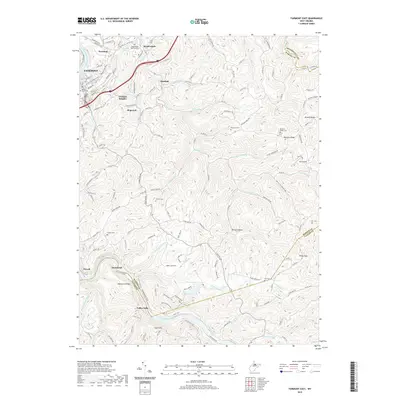
2019 Map of Fairmont East
USGS Topo · Published 2019About this map
Fairmont and its eastern outskirts are defined by the convergence of the Monongahela River and the Tygart Valley River, where the terrain transitions into the steep ridges and hollows of the Appalachian plateau. The landscape is a network of small settlements and family-named landmarks, reflecting the rural residential patterns of eastern Marion County. Deeply incised drainages like Prickett Cr and Goose Creek dictate the layout of the local road system, which connects outlying communities such as Bunners Ridge, Hopewell, and Meadowdale. A high density of small cemeteries, including Vincent Cem, Nuzum Cem, and the Hayhurst Cem, suggests a long history of family homesteads throughout these hills. At the southern edge of the map, Valley Falls marks a significant geological point on the Tygart Valley River, while the presence of Linn Chapel and Linn Cem near Hammond provides valuable points of interest for local history and genealogical research.
Find a feature on this map
147 named features on this map. Tap any name to fly to it.
Don’t see what you’re looking for? This feature index may not catch every label — zoom into the map to look around manually.
Map Details
Editions of this 2019 Fairmont East Map
This is the sole edition of this map. No revisions or reprints were ever made.
Other maps of this area

1886 · St. George
USGS Topo · 1:125,000

1891 · St. George
USGS Topo · 1:125,000

1902 · Fairmont
USGS Topo · 1:62,500

1902 · Morgantown
USGS Topo · 1:62,500

1904 · Blacksville
USGS Topo · 1:62,500

1907 · Thornton
USGS Topo · 1:62,500

1923 · Blacksville
USGS Topo · 1:62,500

1923 · Fairmont
USGS Topo · 1:62,500

1925 · Blacksville
USGS Topo · 1:62,500

1925 · Morgantown
USGS Topo · 1:62,500