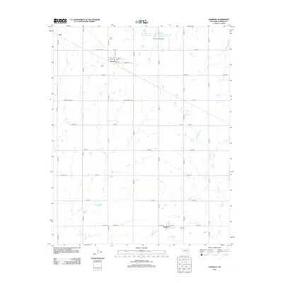
2012 Map of Fairmont
USGS Topo · Published 2012About this map
Fairmont serves as a central hub in this Garfield County landscape, where the intersection of Main St and Buffalo St anchors the local community. To the north, Etna sits near the upper reaches of the drainage system, while Douglas lies to the south along the rail line near Union Cem. This 2012 survey illustrates a landscape defined by its agricultural grid and water management, featuring reservoirs like Upper Black Bear Cr Site 35 Reservoir and Upper Black Bear Cr Site 36 Reservoir. The region is dissected by several winding waterways, most notably Bitter Cr and Otter Cr, which flow through the sectioned plains. For those interested in local genealogy or aviation history, the map provides specific locations for Collett Cem and the Fairmont Field Airport.
Find a feature on this map
38 named features on this map. Tap any name to fly to it.
Don’t see what you’re looking for? This feature index may not catch every label — zoom into the map to look around manually.
Map Details
Editions of this 2012 Fairmont Map
This is the sole edition of this map. No revisions or reprints were ever made.
Other maps of this area

1893 · Lovell
USGS Topo · 1:62,500

1893 · Hennessey
USGS Topo · 1:62,500

1955 · Enid East
USGS Topo · 1:24,000

1955 · Enid
USGS Topo · 1:250,000

1956 · Garber
USGS Topo · 1:62,500

1956 · Hennessey
USGS Topo · 1:62,500

1956 · Enid
USGS Topo · 1:62,500

1958 · Enid
USGS Topo · 1:250,000

1974 · Marshall West
USGS Topo · 1:24,000

1974 · Marshall East
USGS Topo · 1:24,000