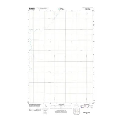
2011 Map of Fairmount NW
USGS Topo · Published 2011About this map
The Wild Rice River meanders across this rural section of Richland County, defining the drainage patterns of an landscape organized by the Public Land Survey System. The map shows the late 20th-century transition to a formal county road network, where local routes like 177th Ave SE and 81st St SE create a rigid grid that contrasts with the river's natural curves. This area near the Minnesota border is characterized by large-scale agricultural plots and vital transport corridors, including County Rd 81 and County Rd 16, which provide the primary infrastructure for the region's farming economy. The map is a clean representation of the Red River Valley's geography, showing how modern land management and road engineering have structured the prairie.
Find a feature on this map
15 named features on this map. Tap any name to fly to it.
Don’t see what you’re looking for? This feature index may not catch every label — zoom into the map to look around manually.
Map Details
Editions of this 2011 Fairmount NW Map
This is the sole edition of this map. No revisions or reprints were ever made.
Other maps of this area

1904 · Wahpeton
USGS Topo · 1:125,000

1953 · Fargo
USGS Topo · 1:250,000

1956 · Fargo
USGS Topo · 1:250,000

1960 · Mooreton East
USGS Topo · 1:24,000

1964 · Fairmount NW
USGS Topo · 1:24,000

1964 · Hankinson SE
USGS Topo · 1:24,000

1964 · Great Bend
USGS Topo · 1:24,000

1964 · Dwight
USGS Topo · 1:24,000

1964 · Wahpeton
USGS Topo · 1:24,000
1972 · Sonora
USGS Topo · 1:24,000