
1964 Map of Great Bend
USGS Topo · Published 1965About this map
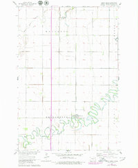
The Wild Rice River carves a complex, winding path through the southern half of this Richland County landscape, defining the rural character of the region in the mid-1960s. The village of Great Bend sits near a prominent loop in the river, serving as a focal point for the surrounding agricultural townships of Brandenburg, Mooreton, Center, and Summit. This survey captures the area just as the Northern Pacific railroad line provided a vital north-south link through the prairie, passing through the heart of the settlement. To the south of the village, Trinity Cem stands as a significant local landmark for genealogical research. The northern reaches are drained by the South Branch Antelope Creek, illustrating the transition from the deeply meandered river valley to the more linear drainage patterns of the open North Dakota plains.
Find a feature on this map
9 named features on this map. Tap any name to fly to it.
Don’t see what you’re looking for? This feature index may not catch every label — zoom into the map to look around manually.
Map Details
Editions of this 1964 Great Bend Map
2 editions found
Other maps of this area

1904 · Wahpeton
USGS Topo · 1:125,000

1953 · Fargo
USGS Topo · 1:250,000

1956 · Fargo
USGS Topo · 1:250,000

1960 · Mooreton West
USGS Topo · 1:24,000

1960 · Mooreton East
USGS Topo · 1:24,000

1964 · Hankinson
USGS Topo · 1:24,000

1964 · Fairmount NW
USGS Topo · 1:24,000

1964 · Mantador
USGS Topo · 1:24,000

1964 · Hankinson SE
USGS Topo · 1:24,000

1964 · Dwight
USGS Topo · 1:24,000