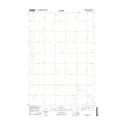
2014 Map of Fairmount NW
USGS Topo · Published 2014About this map
Wild Rice River meanders across this rural landscape in Center Township, defining the drainage patterns of Richland County in the early 21st century. The map reveals a strictly regulated agrarian grid, where section lines are traced by a network of gravel and paved roads including 81st St SE, 83rd St SE, and the prominent CR-16 corridor. This particular survey highlights the subtle topography of the Red River Valley, where the lack of dramatic elevation change emphasizes the vital role of the river as the primary natural landmark. The geometric precision of roads like 177th Ave SE and 180th Ave SE illustrates a landscape optimized for large-scale agriculture, showing how the contemporary North Dakota prairie is partitioned for modern production.
Find a feature on this map
15 named features on this map. Tap any name to fly to it.
Don’t see what you’re looking for? This feature index may not catch every label — zoom into the map to look around manually.
Map Details
Editions of this 2014 Fairmount NW Map
This is the sole edition of this map. No revisions or reprints were ever made.
Other maps of this area

1904 · Wahpeton
USGS Topo · 1:125,000

1953 · Fargo
USGS Topo · 1:250,000

1956 · Fargo
USGS Topo · 1:250,000

1960 · Mooreton East
USGS Topo · 1:24,000

1964 · Fairmount NW
USGS Topo · 1:24,000

1964 · Hankinson SE
USGS Topo · 1:24,000

1964 · Great Bend
USGS Topo · 1:24,000

1964 · Dwight
USGS Topo · 1:24,000

1964 · Wahpeton
USGS Topo · 1:24,000
1972 · Sonora
USGS Topo · 1:24,000