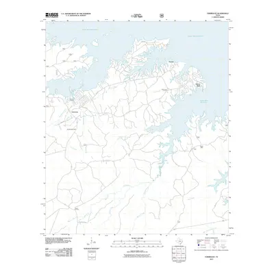
2010 Map of Fairmount
USGS Topo · Published 2010About this map
The Toledo Bend Reservoir dominates the northern and eastern portions of this Sabine County landscape, where flooded inlets reach deep into the wooded drainages of East Texas. The small community of Fairmount sits inland, near a network of local roads and the prominent Fox Hunters Hill. This area is characterized by its numerous watercourses, including Lows Creek and Mill Creek, which feed into the reservoir system. Local genealogy and history are anchored by several established burial grounds, such as Fairmount Cemetery, Mount Sinai Cemetery, and Weaver Cemetery, often located near these early settlements and family landmarks. Higher ground is marked by features like Hickory Ridge and the Sand Hills, providing a clear view of how the topography dictated settlement patterns before and after the reservoir's creation.
Find a feature on this map
31 named features on this map. Tap any name to fly to it.
Don’t see what you’re looking for? This feature index may not catch every label — zoom into the map to look around manually.
Map Details
Editions of this 2010 Fairmount Map
This is the sole edition of this map. No revisions or reprints were ever made.
Other maps of this area

1944 · Negreet
USGS Topo · 1:62,500

1944 · Wiergate
USGS Topo · 1:62,500

1948 · Wiergate
USGS Topo · 1:62,500

1953 · Alexandria
USGS Topo · 1:250,000

1954 · Wiergate
USGS Topo · 1:24,000

1954 · Toro
USGS Topo · 1:24,000

1954 · Wiergate SE
USGS Topo · 1:24,000

1954 · Columbus
USGS Topo · 1:24,000

1954 · Fairdale
USGS Topo · 1:24,000

1954 · Negreet
USGS Topo · 1:62,500