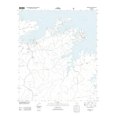
2012 Map of Fairmount
USGS Topo · Published 2012About this map
Toledo Bend Reservoir dominates the eastern horizon of this landscape, its intricate shoreline creating numerous inlets and points along the Sabine County border. The settlement of Fairmount and the residential area of Hickory Ridge are focal points for local history, surrounded by a dense network of forest roads and creek systems. Family history and genealogy are well-represented by several burial grounds, including Fairmount Cem, Clark Dickey Cem, and Mt Sinai Cem, which are scattered throughout the piney woods and along old routes like Old Lake Rd.
Find a feature on this map
66 named features on this map. Tap any name to fly to it.
Don’t see what you’re looking for? This feature index may not catch every label — zoom into the map to look around manually.
Map Details
Editions of this 2012 Fairmount Map
This is the sole edition of this map. No revisions or reprints were ever made.
Other maps of this area

1944 · Negreet
USGS Topo · 1:62,500

1944 · Wiergate
USGS Topo · 1:62,500

1948 · Wiergate
USGS Topo · 1:62,500

1953 · Alexandria
USGS Topo · 1:250,000

1954 · Wiergate
USGS Topo · 1:24,000

1954 · Toro
USGS Topo · 1:24,000

1954 · Wiergate SE
USGS Topo · 1:24,000

1954 · Columbus
USGS Topo · 1:24,000

1954 · Fairdale
USGS Topo · 1:24,000

1954 · Negreet
USGS Topo · 1:62,500