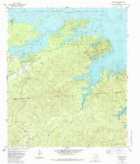
1985 Map of Fairmount
USGS Topo · Published 1985About this map
The Toledo Bend Reservoir dominates the northern and eastern reaches of this East Texas landscape, where the waters of the Sabine River back into numerous creek drainages. Much of the land is preserved within the Sabine National Forest, creating a mosaic of timbered ridges and alluvial bottomlands. The settlement of Fairmount serves as a local hub, situated near the Willow Oak Recreation Area and the winding course of Lows Creek.
Find a feature on this map
27 named features on this map. Tap any name to fly to it.
Don’t see what you’re looking for? This feature index may not catch every label — zoom into the map to look around manually.
Map Details
Editions of this 1985 Fairmount Map
This is the sole edition of this map. No revisions or reprints were ever made.
Other maps of this area

1944 · Negreet
USGS Topo · 1:62,500

1944 · Wiergate
USGS Topo · 1:62,500

1948 · Wiergate
USGS Topo · 1:62,500

1953 · Alexandria
USGS Topo · 1:250,000

1954 · Wiergate
USGS Topo · 1:24,000

1954 · Toro
USGS Topo · 1:24,000

1954 · Wiergate SE
USGS Topo · 1:24,000

1954 · Columbus
USGS Topo · 1:24,000

1954 · Fairdale
USGS Topo · 1:24,000

1954 · Negreet
USGS Topo · 1:62,500