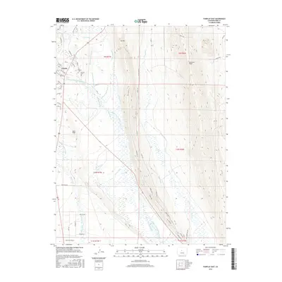
2016 Map of Fairplay East
USGS Topo · Published 2016About this map
The town of Fairplay serves as the focal point for this high-altitude landscape, where the Middle Fork South Platte River winds through a complex system of irrigation and water management. Significant genealogical sites include the Old Fairplay Cem and the Fairplay Cem, resting on the edge of the settlement near the riverbanks. The terrain is defined by prominent elevations such as Red Hill, Reinecker Ridge, and Meier Ridge, which hem in the river valley. A dense network of historical water diversions, including the Raynor-Edmonson Ditches, Alkaline Ditch, and Siggins Ditch, reveals the area's agricultural reliance on redirected mountain runoff. Numerous other channels like Bonell Ditch and Mahee Ditch crisscross the valley floor, illustrating how the high plains were adapted for ranching and settlement during this era.
Find a feature on this map
56 named features on this map. Tap any name to fly to it.
Don’t see what you’re looking for? This feature index may not catch every label — zoom into the map to look around manually.
Map Details
Editions of this 2016 Fairplay East Map
This is the sole edition of this map. No revisions or reprints were ever made.
Other maps of this area

1889 · Leadville
USGS Topo · 1:125,000

1891 · Leadville
USGS Topo · 1:125,000

1934 · Climax
USGS Topo · 1:48,000

1937 · Como
USGS Topo · 1:62,500

1938 · Mt. Lincoln
USGS Topo · 1:48,000

1942 · Leadville
USGS Topo · 1:125,000

1945 · Mount Lincoln
USGS Topo · 1:62,500

1953 · Denver
USGS Topo · 1:250,000

1956 · Elkhorn
USGS Topo · 1:24,000

1956 · Garo
USGS Topo · 1:24,000