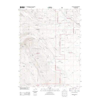
2013 Map of Fairplay West
USGS Topo · Published 2013About this map
Fairplay serves as the gateway to this high-altitude landscape in the Pike National Forest, where the transition from alpine peaks to valley floor is marked by an intricate network of early industrial infrastructure. The presence of the Duguesne Smelter and the Abandon Rail Rd northwest of town highlights the area's legacy of ore processing and transport. Water management is a central theme of this terrain, evidenced by the extensive system of ditches like the Fairplay Mining Ditch, Westerman Ditch, and Pearl Upper Ditch, which redirected flows from the Middle Fork South Platte River and its tributaries. Further south, the landscape shifts toward the thermal features of Rhodes Warm Springs and the small settlement of Mullenville, while the high ridgelines of the Mosquito Range and peaks like Sheep Mountain dominate the western horizon.
Find a feature on this map
98 named features on this map. Tap any name to fly to it.
Don’t see what you’re looking for? This feature index may not catch every label — zoom into the map to look around manually.
Map Details
Editions of this 2013 Fairplay West Map
This is the sole edition of this map. No revisions or reprints were ever made.
Other maps of this area

1889 · Leadville
USGS Topo · 1:125,000

1891 · Leadville
USGS Topo · 1:125,000

1934 · Climax
USGS Topo · 1:48,000

1937 · Como
USGS Topo · 1:62,500

1938 · Mt. Lincoln
USGS Topo · 1:48,000

1942 · Leadville
USGS Topo · 1:125,000

1945 · Mount Lincoln
USGS Topo · 1:62,500

1953 · Denver
USGS Topo · 1:250,000

1956 · Garo
USGS Topo · 1:24,000

1956 · Fairplay East
USGS Topo · 1:24,000