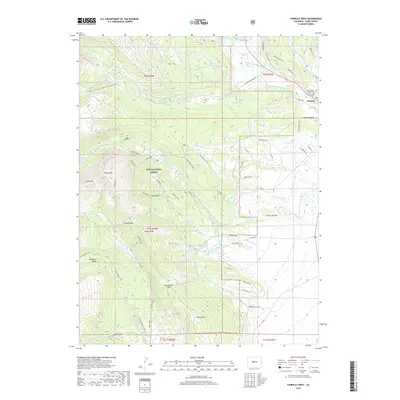
2019 Map of Fairplay West
USGS Topo · Published 2019About this map
The Middle Fork S Platte River winds through high-altitude terrain where the historic settlement of Fairplay serves as a focal point, anchored by the Park County Courthouse. This 2019 survey captures an intricate network of irrigation and mining infrastructure, including the Fairplay Mining Ditch, Westerman Ditch, and High Cr Ditch, reflecting the long-standing water management traditions of the region. To the west, the landscape rises sharply into the Mosquito Range and the protected lands of the Pike National Forest. High-elevation landmarks like Twelvemile Lake and the peak of Sheep Mtn are accessible via established routes such as Brown's Pass and the Tie Hack trail. Geologic and hydrologic features are notably present, from the thermal waters at Rhodes Warm Springs to the secluded Mudsill Spring, providing a detailed look at the area's natural resource distribution.
Find a feature on this map
73 named features on this map. Tap any name to fly to it.
Don’t see what you’re looking for? This feature index may not catch every label — zoom into the map to look around manually.
Map Details
Editions of this 2019 Fairplay West Map
This is the sole edition of this map. No revisions or reprints were ever made.
Other maps of this area

1889 · Leadville
USGS Topo · 1:125,000

1891 · Leadville
USGS Topo · 1:125,000

1934 · Climax
USGS Topo · 1:48,000

1937 · Como
USGS Topo · 1:62,500

1938 · Mt. Lincoln
USGS Topo · 1:48,000

1942 · Leadville
USGS Topo · 1:125,000

1945 · Mount Lincoln
USGS Topo · 1:62,500

1953 · Denver
USGS Topo · 1:250,000

1956 · Garo
USGS Topo · 1:24,000

1956 · Fairplay East
USGS Topo · 1:24,000