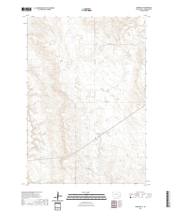
2021 Map of Fairpoint SE
USGS Topo · Published 2021About this map
The high plains of Meade County are defined by a network of drainage systems and rural transit routes in this modern survey. E Elm Cr and Elm Cr carve through the landscape, providing the primary topographic variation in an area characterized by its wide-reaching township and range boundaries. The infrastructure here is primarily geared toward ranching and local access, with named corridors such as Chalk Butte Rd and Wilcox Rd connecting the scattered homesteads. The surveyor's grid is prominently marked, showing the intersections of t7n r11e and surrounding townships. This 2021 update illustrates the enduring layout of the rural South Dakota landscape, where the placement of Laredo Pl and Mandan Loop suggests the continued importance of these named arteries for navigating the expansive territory between seasonal creek beds.
Find a feature on this map
14 named features on this map. Tap any name to fly to it.
Don’t see what you’re looking for? This feature index may not catch every label — zoom into the map to look around manually.
Map Details
Editions of this 2021 Fairpoint SE Map
This is the sole edition of this map. No revisions or reprints were ever made.
Other maps of this area

1953 · Hereford
USGS Topo · 1:24,000

1953 · Hereford NE
USGS Topo · 1:24,000

1953 · Rapid City
USGS Topo · 1:250,000

1954 · Haydraw
USGS Topo · 1:24,000

1957 · Rapid City
USGS Topo · 1:250,000

1959 · Fairpoint
USGS Topo · 1:24,000

1959 · Fairpoint SW
USGS Topo · 1:24,000

1959 · Stoneville
USGS Topo · 1:24,000

1959 · Union Center
USGS Topo · 1:24,000

1959 · Fairpoint NW
USGS Topo · 1:24,000