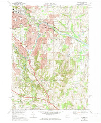
1971 Map of Fairport
USGS Topo · Published 1974About this map
The Erie Canal cuts through the heart of this landscape, anchoring the bustling villages of Fairport and East Rochester during a period of significant suburban expansion. The 1971 surveying reveals a transition from these dense village centers to the high ridges of Turk Hill and Baker Hill, where the topography reflects the glacial history of the Irondequoit watershed. The transportation corridor is particularly complex, showing the modern New York State Thruway intersecting with the historic Penn Central and the legacy of the Lehigh Valley Railroad Grade. Genealogists will find notable detail in the suburban reaches, from the expansive White Haven Memorial Park to smaller sites like Water Cem. The map also captures several distinct hamlets and crossroad settlements such as Bushnell Basin, Egypt, and Fishers, alongside numerous educational institutions like Fairport High Sch and Brown Jr High Sch.
Find a feature on this map
51 named features on this map. Tap any name to fly to it.
Don’t see what you’re looking for? This feature index may not catch every label — zoom into the map to look around manually.
Map Details
Editions of this 1971 Fairport Map
3 editions found
Other maps of this area

1895 · Rochester
USGS Topo · 1:62,500

1898 · Rochester
USGS Topo · 1:62,500

1900 · Macedon
USGS Topo · 1:62,500

1900 · Canandaigua
USGS Topo · 1:62,500

1901 · Honeoye
USGS Topo · 1:62,500

1903 · Canandaigua
USGS Topo · 1:62,500

1904 · Honeoye
USGS Topo · 1:62,500

1912 · Rochester
USGS Topo · 1:62,500

1920 · Rochester
USGS Topo · 1:62,500

1931 · Mendon Ponds
USGS Topo · 1:24,000